
Stage races and marathons
Multi-day epics, technical marathons, cross-country routes and long training objectives with real terrain character.
From MTB stage races and marathons to gran fondos, gravel adventures, trail races and ultras, the route can become a physical object with terrain, colour and the details that matter.
Send your route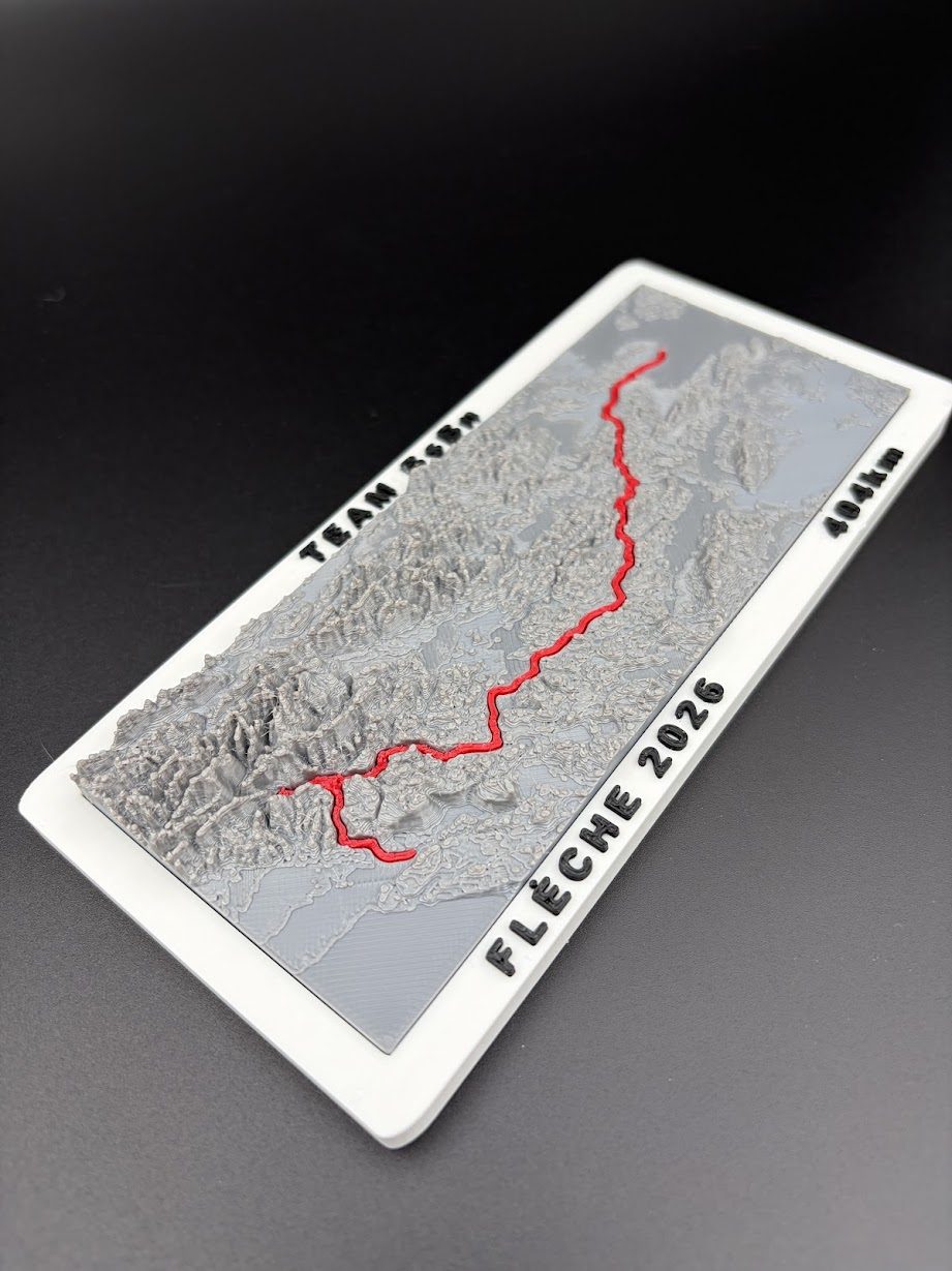
A GPX track shows where you travelled. A Finisher Map adds the landscape that made the route memorable. Elevation data creates the physical relief, while the recorded line follows the same climbs, valleys, ridges and coastlines you crossed on the bike or on foot.
The map can be built around one continuous course, a multi-stage event, a loop or an out-and-back route. The base shape, base colour and route colours can all be adapted. Text and branding can identify the event, date, distance, climbing, rider, team, club, sponsor, result or a short dedication.
You do not need a prepared production model. The original GPX file, a public route link or an official event page is enough for the first feasibility review.
This page focuses on the categories that overlap the most visually and commercially: MTB, cycling and trail running.
Multi-day epics, technical marathons, cross-country routes and long training objectives with real terrain character.
Gran fondos, Everesting rides, personal challenges, sportives and memorable point-to-point routes.
Mountain races, ultras, ridge traverses and route profiles where elevation is part of the story.
Annual rides, club milestones, partner sets and small internal awards built around a shared route.
The same route system can expand into awards, finisher gifts, event merchandise or starter-pack add-ons.
The route that matters to one rider or runner can be stronger than the biggest event on the calendar.
Every commission begins with a short review. The route length, terrain area and desired display size determine the right level of detail.
Email the GPX file, public route link or event and year. If the route has several stages or disciplines, label them clearly.
Choose the information that belongs on the piece: name, team, date, distance, climbing, time, result, place or personal message.
We agree on the base shape, orientation, approximate size, base and route colours, branding, and whether the route should be one piece, several stages or a modular set.
You receive a clear scope and price before production. Event and club orders can begin with one physical sample.
The map is produced and checked in Zagreb, then prepared for delivery in Croatia or the EU.
Use the original GPX export when possible. A screenshot is useful for explaining the idea, but it does not contain the coordinates needed to place the route accurately over terrain.
For an event route, include the exact year. Courses change, sometimes significantly, and the value of a finisher map depends on representing the route you actually completed.
Files can be attached directly to an email at info@bearhill.eu. If your project is more mountain-focused, see the dedicated hiking and mountaineering page.
Most routes can be reviewed, but the final result depends on distance, geographic area, terrain detail and desired size. Very long routes may need simplification, a larger format or several connected pieces.
Send the public link for an initial review. The original GPX export is still the best source when it is available.
Yes. A multi-day route can use separate lines on one landscape or several modular pieces. The better option depends on distance and geography.
Custom pricing depends on map size, terrain area, route complexity, personalisation, quantity and finishing requirements. Send the route and expected size for a quote. Ready-made maps in the current 4Islands collection start at €25.
Yes. Individual personal maps, club batches and event editions are all possible. There is no need to begin with a large quantity. Organisers should contact us at least a few weeks before the event, with more time allowed for larger or highly personalised editions.
Send the race or route name, year, the details you want on the map and the delivery country. A short message is enough for the first review.
Email: info@bearhill.eu
WhatsApp: +385 91 527 2499
WhatsApp messages only. This number is not used for phone calls.
For GPX, logo or photo attachments, email the files after submitting and use the same name.