
Several days, one story
Separate stages can be linked across one landscape or built as pieces that display together.
Custom relief maps for MTB marathons, stage races and personal trail goals. Made for the riders who remember the terrain long after the timing sheet.
Send your MTB route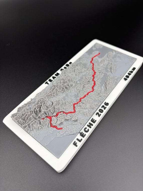
Distance alone cannot explain an MTB course. Surface, elevation, exposure, ridgelines and the shape of the surrounding mountains or coastline all change how the day feels. Relief lets the route sit on the same geography that created the challenge.
A one-day marathon can become one focused piece. A multi-day stage race can be shown as one landscape, a sequence of stages or a modular collection. Rider name, race year, team, distance, climbing and finishing time can be added when they support the story rather than crowd the map.
Finisher Maps is interested in the full range of mountain bike goals, not only podiums and professional results.
Separate stages can be linked across one landscape or built as pieces that display together.
A concentrated record of the loop, mountain range and elevation that shaped the effort.
Matching maps for partners with individual names, times or short messages.
A club route edition for members, volunteers, supporters or a significant anniversary.
Small pilot series, award concepts and route-specific gifts for an event.
The route does not need a famous name. A hard line created with friends can matter more.
The first Finisher Maps collection grew from the 4Islands route across Krk, Cres, Unije and Lošinj. The same idea can be applied to other types of European mountain bike racing where terrain is central to the experience.
An Alpine stage race such as Swiss Epic spreads the story across several days and valleys. A long marathon such as the Salzkammergut Trophy concentrates the challenge into one major route with several distance options. Alpentour Trophy, Cape Epic and local cross-country stage events each create a different mapping problem because the geography, stage structure and route density are different.
These event names illustrate the kinds of MTB routes that can be reviewed. Finisher Maps is not affiliated with, endorsed by or sponsored by 4Islands Epic, Swiss Epic, Salzkammergut Trophy, Alpentour Trophy, Cape Epic, Epic Series, IRONMAN or any other event mentioned.
Best for a compact one-day course or a route that sits inside one mountain area. The terrain remains legible and the course can be followed without breaking the story into separate objects.
Best when each day has a clear identity, start and finish. Stage colours or labels can separate the days while keeping the overall landscape consistent.
Best when the race moves between islands, regions or terrain blocks. Separate pieces can make geography clearer and allow the rider to display the event in a more flexible way.
A good finisher map does not need every metric from the activity file. The strongest details are usually the race name, year, rider or team, total distance, climbing and finishing time. A short dedication can be included for a gift.
For two-person stage races, a matching pair of maps can carry each rider's name while keeping the shared route identical. For clubs and organisers, a common edition can leave room for numbered plates or a small variable detail.
The current collection covers all five stages across four connected island tiles. A single island costs €25 and the complete set costs €129, plus shipping.
Explore 4Islands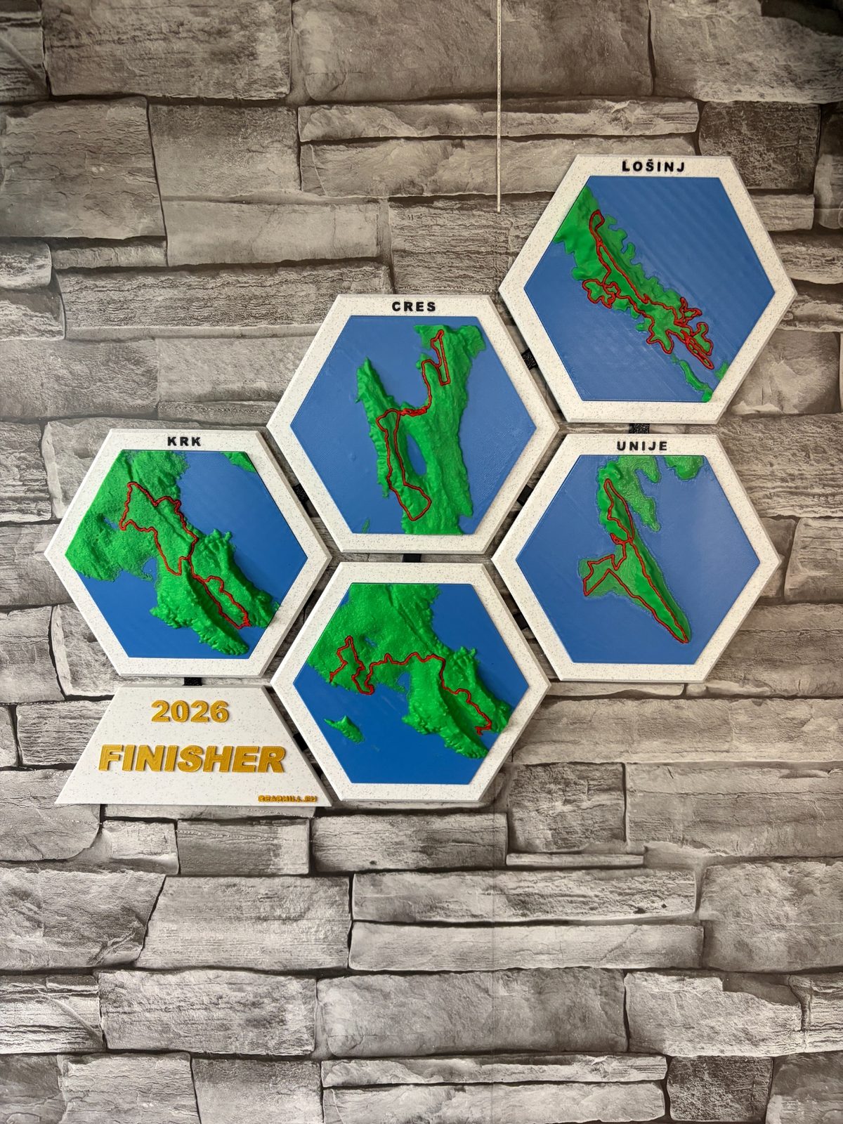
Send the race or route name, year, the details you want on the map and the delivery country. A short message is enough for the first review.
Email: info@bearhill.eu
WhatsApp: +385 91 527 2499
WhatsApp messages only. This number is not used for phone calls.
For GPX, logo or photo attachments, email the files after submitting and use the same name.