
One course, one mountain
A compact event route with enough terrain detail to understand every major climb and descent.
A custom relief map built from the course you ran and the terrain that made every kilometre count.
Send your running route
Elevation, exposure, surface and the shape of the mountain decide how a trail race feels. Two routes with the same distance can demand completely different preparation and leave completely different memories.
A Finisher Map combines the recorded or official course with the surrounding relief. The line can be supported by the race name, year, distance, climbing, runner, finishing time and a short dedication, while the landscape remains the main visual element.
The course does not need global recognition. It needs a strong connection to the person who ran it.
A compact event route with enough terrain detail to understand every major climb and descent.
A wider landscape, clean route line and carefully selected data to avoid visual overload.
Daily tracks can use separate colours, labels or modular map pieces.
A ridge traverse, summit link-up, fastest-known-time attempt or route invented with friends.
Name, event year and result make the map personal without turning it into a crowded certificate.
A shared course design adapted for small batches, podium awards or sponsor gifts.
Trail routes often overlap visually because a climb and descent use the same valley or ridge. The map needs enough geographic context to stay recognisable, but not so much that the course becomes a thin line in a large region.
The ideal crop depends on the route and display size. A short mountain race can show more local detail. A 100-mile ultra may need a wider view, simplified route treatment or several connected sections.
Distance and elevation are useful, but they are not the whole object. Good personalisation supports the terrain rather than competing with it.
An official race GPX is best when you want the published course. A personal recording is better when the exact route you completed was different because of a diversion, shortened course or personal variation.
Send both when available and explain which story the map should tell. For event editions, the organiser should provide or approve the final route source.
The course can become a base design for finisher gifts, podium awards, volunteer recognition, VIP packages or a limited anniversary series. A physical sample can be produced before a small or larger batch so terrain, text and branding can be reviewed together.
Send the original route, event name and year. We will review the geographic area, terrain and best display approach before quoting.
See the custom map process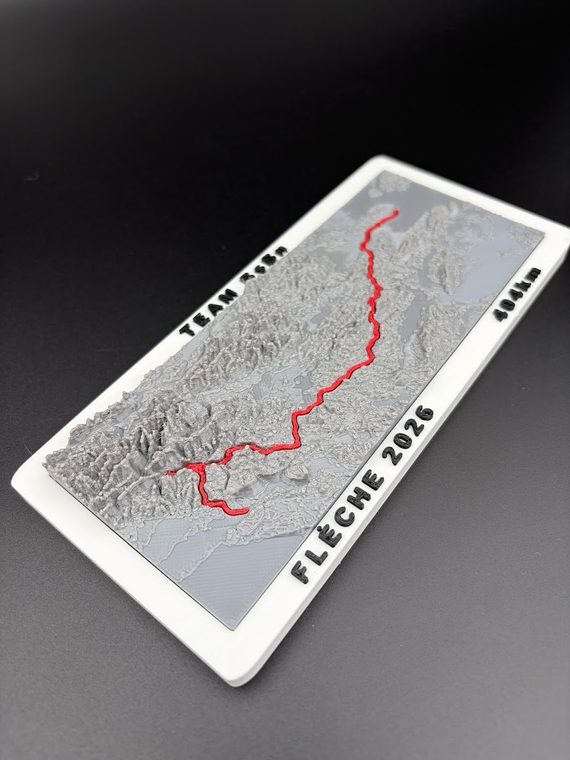
Send the race or route name, year, the details you want on the map and the delivery country. A short message is enough for the first review.
Email: info@bearhill.eu
WhatsApp: +385 91 527 2499
WhatsApp messages only. This number is not used for phone calls.
For GPX, logo or photo attachments, email the files after submitting and use the same name.